July 6, 2023 — A geofence is a virtual boundary or perimeter defined around a specific geographic area. Fleet management systems use geofences to monitor and track vehicles’ movement within designated areas.
While its use cases are spread throughout multiple industries, here’s a glimpse on how geofences are used in fleet management and how you can benefit from them:
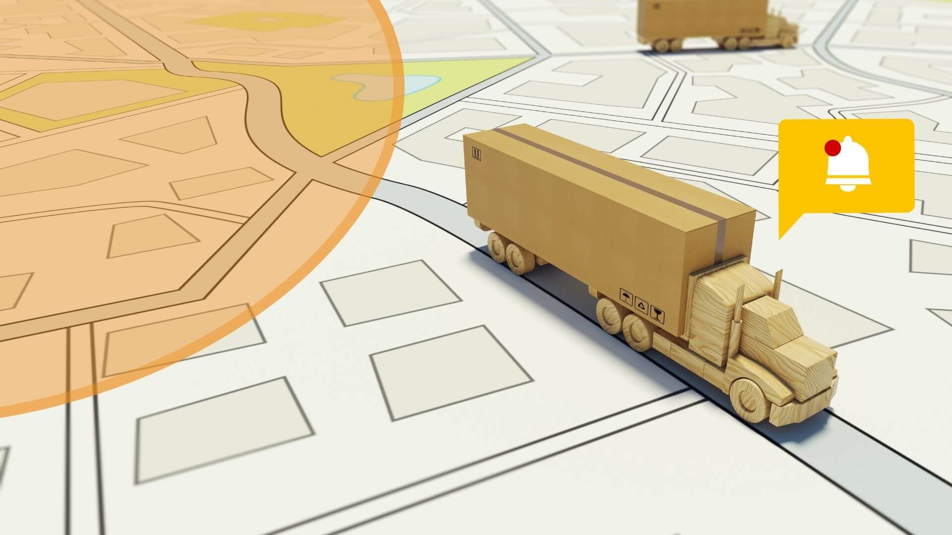
Geofences allow fleet managers to define specific areas of interest such as job sites, customer locations, or no-go zones. When your GPS-equipped vehicles enter or exit these predefined geofenced areas, your fleet management system can trigger alerts or notifications. This feature enables fleet managers to monitor vehicle movements and ensure compliance with route plans and schedules.
One of the biggest perks of implementing geofences is security. You can improve fleet security by receiving real-time alerts when a vehicle enters or exits an unauthorized area. If a vehicle is stolen or deviates from its designated route, the system can immediately notify the necessary personnel, enabling you or your organization to take prompt action.
Petroleum trucks, for example, can be monitored through geofences. Fleet managers will be able to identify if they’ve gone off-route or entered an area known for illegal gasoline siphoning.
With a single glance at a screen, you can be empowered to help prevent cargo theft, vehicle loss, and more.
Apart from security, fleet managers can also utilize geofencing to optimize routing and dispatching. By creating geofences around customer locations or service areas, some fleet management systems can use this to identify and assign the nearest available vehicle to a new job request. This ensures faster response times, reduces fuel consumption, and improves overall operational efficiency.
Geofence data can be analyzed to generate reports and insights for fleet performance evaluation. Fleet managers can review vehicle activity within specific geofenced areas, measure service duration, identify inefficiencies, and make data-driven decisions to optimize operations.
Overall, geofences in fleet management systems provide valuable tools for monitoring vehicle movement, enhancing security, optimizing routing, and improving operational efficiency.
Webcast’s TrackMe Suite and NavX offer fleet management solutions, designed to cater to your business’ needs with multiple use case options available. For more information, questions, or inquiries, visit https://trackme.com.ph/contact-us/.
TRACKME is developed by the pioneer and leader in location-based solutions in the country- Webcast Technologies, Inc. (WTI)
This website uses cookies to ensure you get the best experience on our website. Learn more